- All
- District PDP
- Municipal PDP
- Urban PDP
- Detailed PDP
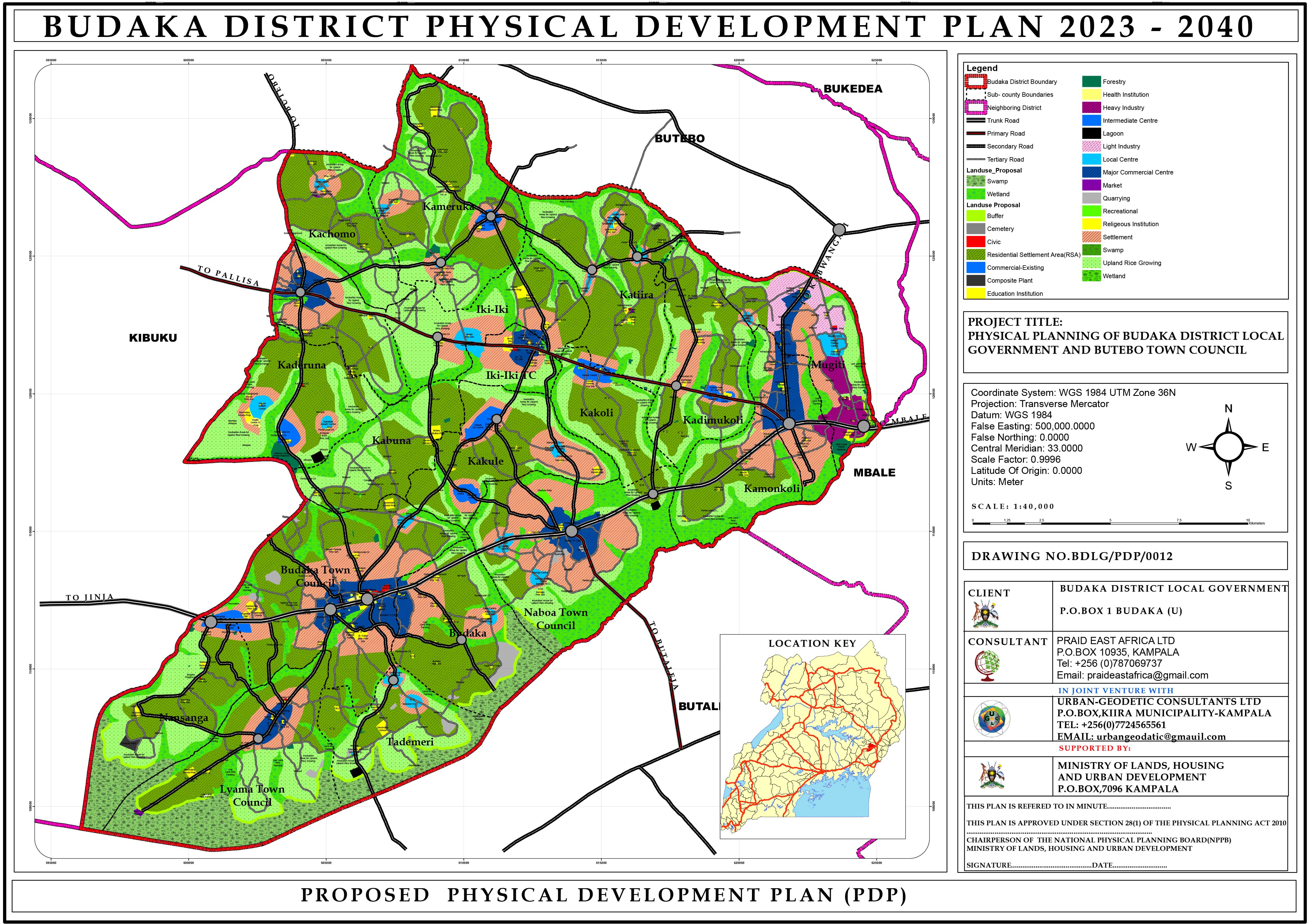
Budaka District Physical Development Plan (2023–2040)
PRAID developed a comprehensive District Physical Development Plan for Budaka District, focusing on future land use, infrastructure, and social service delivery up to 2040. The project involved multi-level stakeholder engagements, data collection, and plan approval by the NPPB. Funded by the Ministry of Lands, it offers a 17-year roadmap for integrated spatial development in Eastern Uganda.
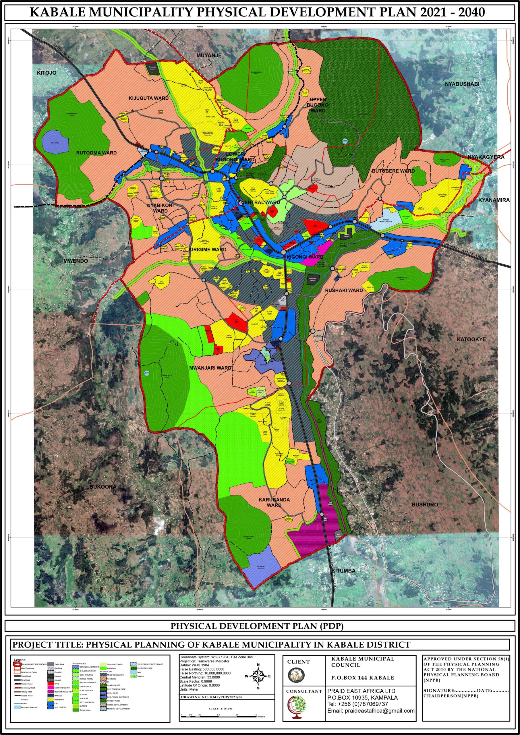
Kabale Municipality Physical Development Plan (2021–2040)
Through funding from the World Bank under the USMID program, PRAID prepared the Kabale Municipal PDP, integrating stakeholder input, socio-economic and spatial data, and community visioning. This strategic plan—completed in 2021—provides a long-term spatial framework for Kabale, including a detailed plan for the Butobere neighborhood.
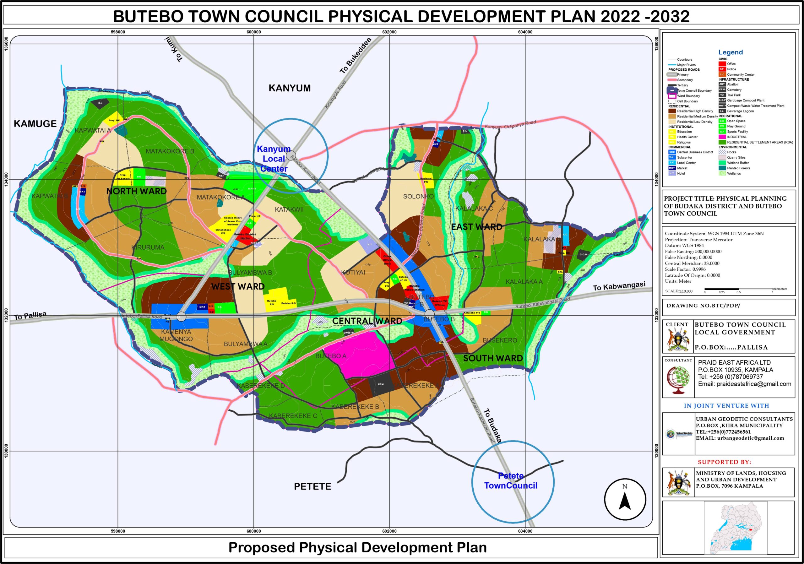
Butebo Town Council Physical Development Plan (2022)
The project involved preparing Physical development plan for Butebo Town Council. It entailed holding consultative engagements, data collection [socio-economic and Geospatial], preparation of reports and thematic maps. It also involved presentation of the draft plan to town and district stakeholders for approval.
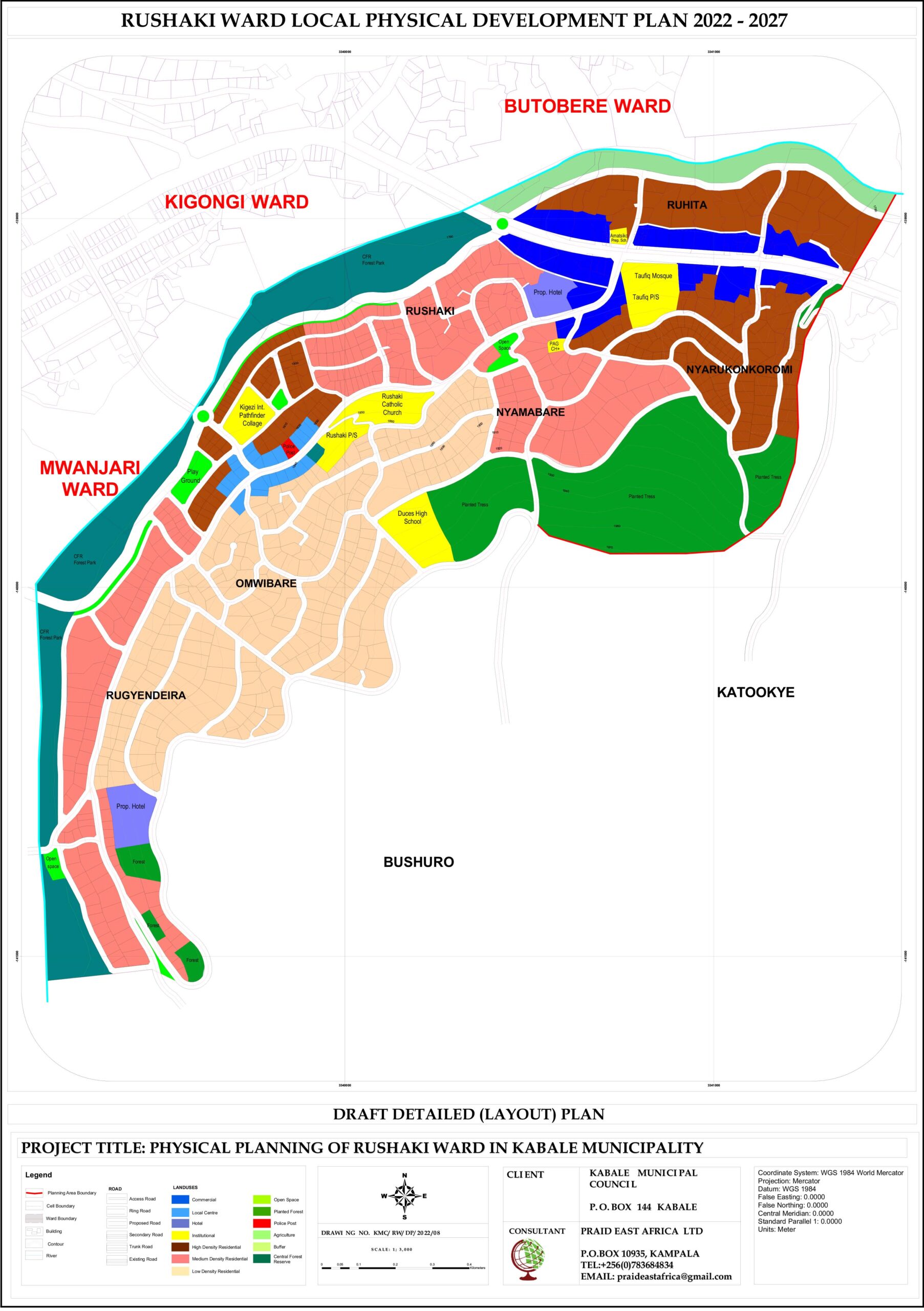
Rushaki Ward Detailed Plan, Kabale Municipality (2022)
Funded under the USMID Program, PRAID prepared a detailed neighborhood plan for Rushaki Ward in Kabale Municipality. The project included field surveys, stakeholder mapping, and participatory planning workshops, culminating in an approved plan by the municipal council to guide future zoning and development.
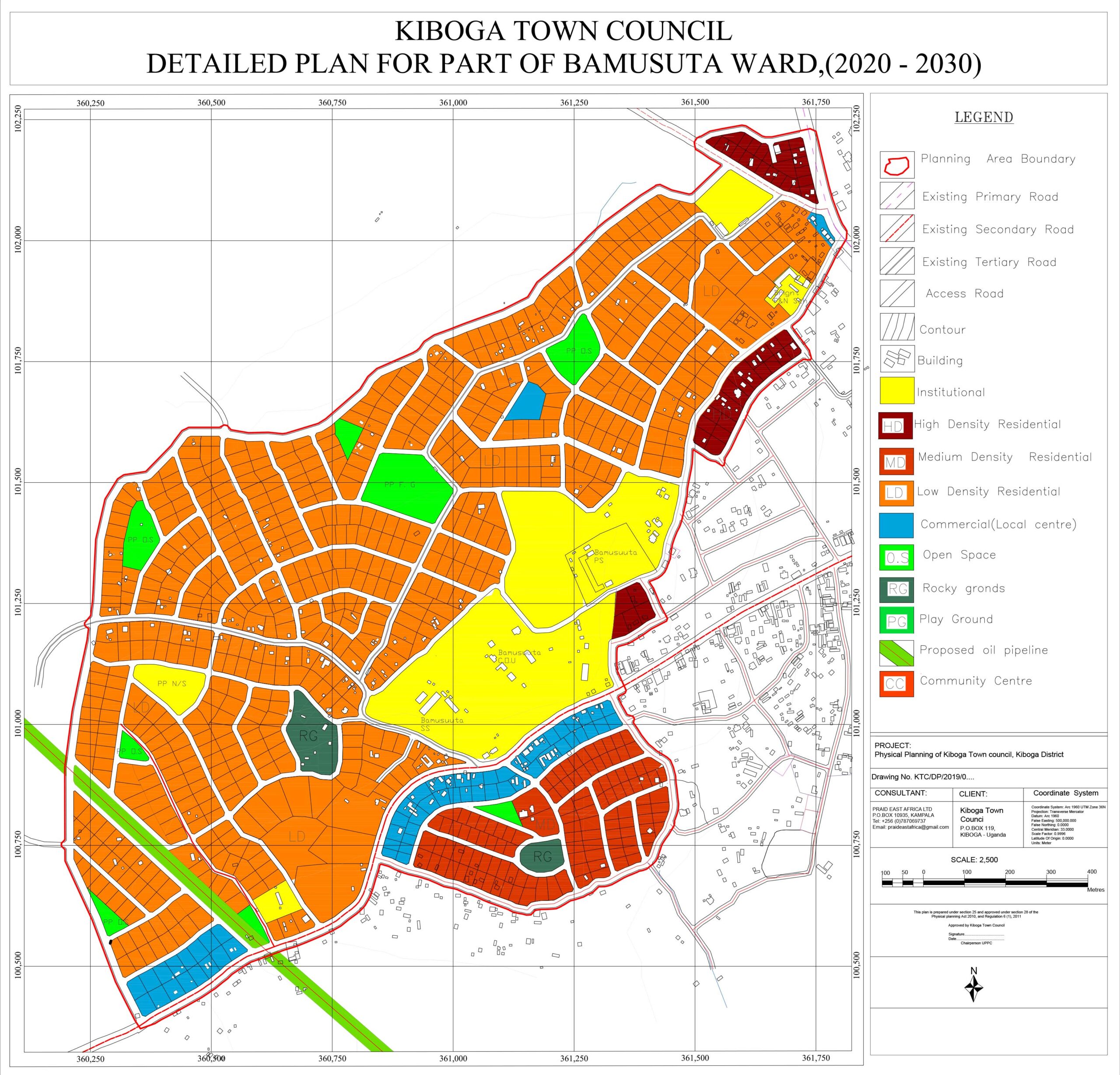
Bamusuuta Ward Detailed Plan, Kiboga Town Council (2020)
This detailed plan for Bamusuuta Ward aimed to guide localized land use and infrastructure development. Conducted in Kiboga Town Council, the assignment involved stakeholder mobilization, visioning sessions, spatial analysis, and final presentation to the urban council. The plan was approved and is now a tool for managing urban growth in the area.